The National Hurricane Center is monitoring an area from the northeast part of the Gulf to the Atlantic just off the southeastern coast of the U.S. There is now a 40% chance of tropical development some time by, or through the holiday weekend.
A front is expected to fade out across the Southeastern U.S. bringing storm activity to the far Northeastern Gulf, Florida, and into the Atlantic just off the southeast coast. Storm activity could gradually form into a broad area of low pressure that could become tropical by or over the holiday weekend.
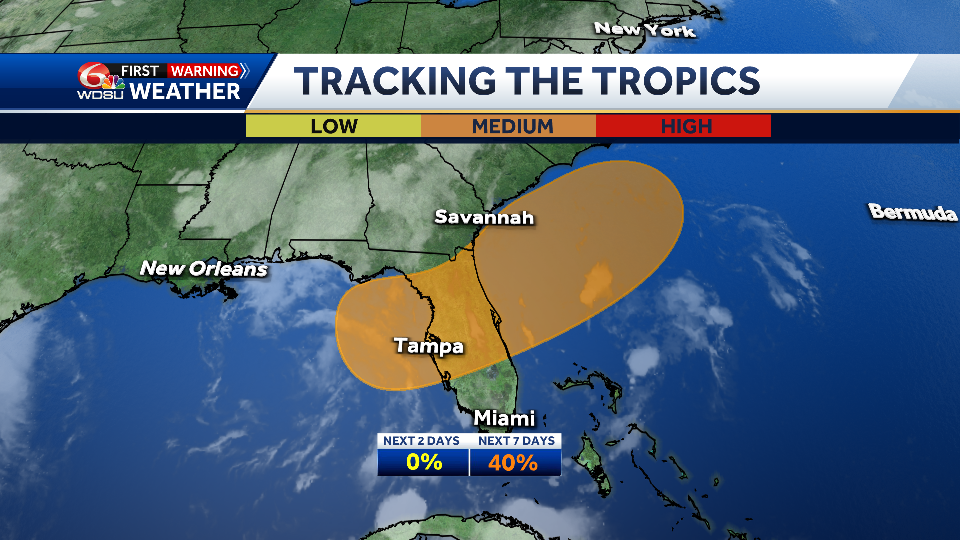
What We Know:
- Chance of development over the next 2 days: Near 0%
- Chance of development over the next 3-7 days: Medium — 40%
- If development occurs, it would be gradual, and the system is expected to move very little.
Impact to Southeast Louisiana:
Forecast information is starting to latch onto possible development likelier off the southeast coast and meandering in the Atlantic over the weekend. This same data point to keeping the “parent” system just off the South Carolina coast into next week then either making landfall in the Palmetto State or moving farther northeast.
There could be a secondary area of spin/energy that begins to move into Southeast Louisiana and next week increasing chances of a heavy rain threat.
Right now, there is low confidence in where these systems will track.
We’ll continue to monitor this evolving forecast.
What It Means For the Forecast:
- Storms are likely from the Northeast Gulf, through Florida, and into the Atlantic just off the southeastern coast by the 4th of July and through the holiday weekend.
- Heavy rain is likely in the Tampa area and through much of the Florida Peninsula.
Stay with the WDSU First Warning Weather team for all of your latest tropical updates.
READ MORE:Up to a 40% chance of tropical development Gulf to southeast coast