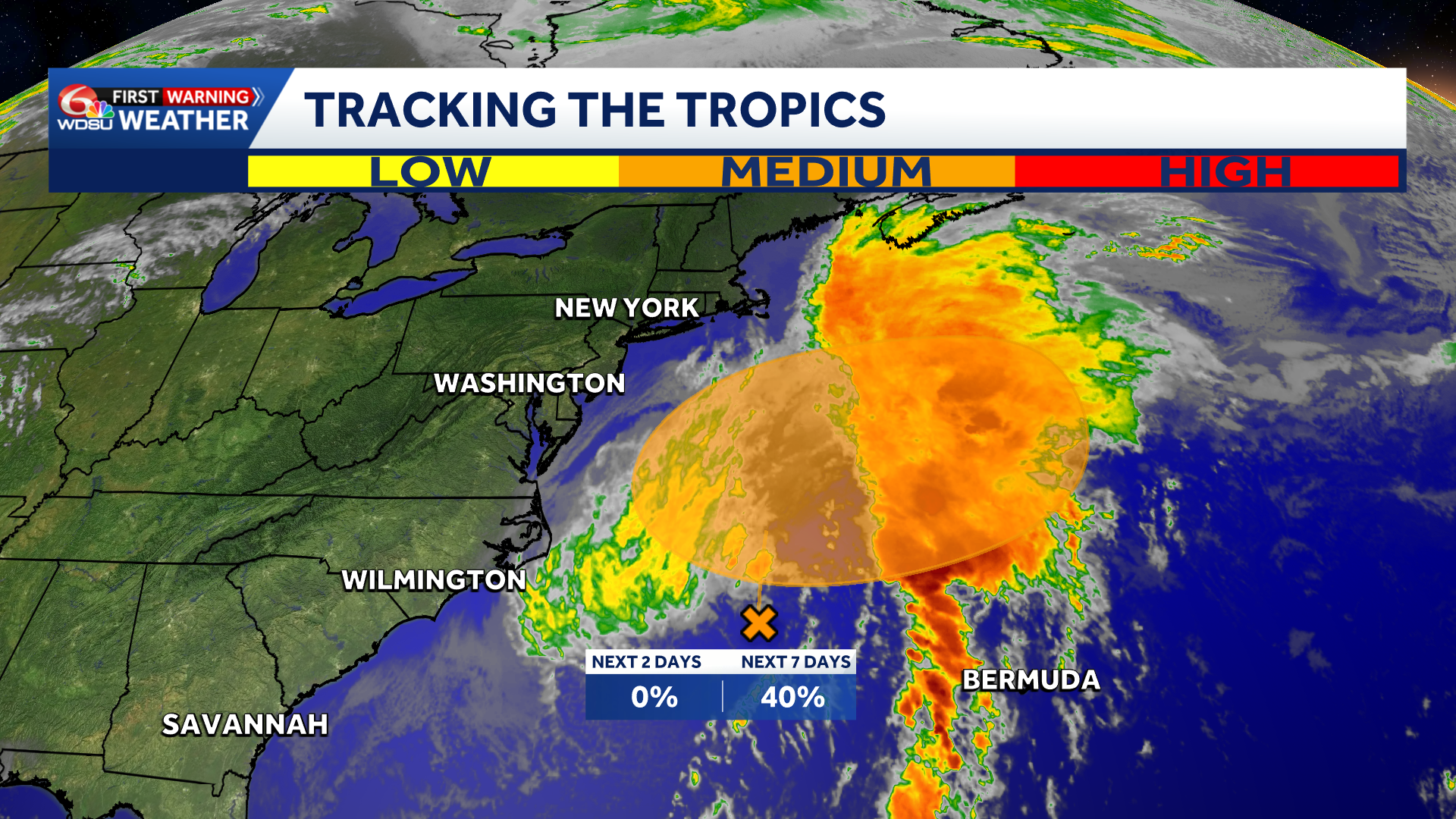
A powerful coastal storm developing off the southeastern United States has a growing chance of acquiring subtropical characteristics later this week, according to the National Hurricane Center.
A storm-force, non-tropical area of low pressure was forming Sunday night along a frontal boundary off the Southeast coast. The system is forecast to move slowly and erratically during the next couple of days while initially remaining non-tropical.
If the low remains over the warm waters of the Gulf Stream, conditions could become more favorable for it to develop subtropical characteristics during the second half of the week. The hurricane center gives the system a near-zero chance of formation through 48 hours and a 40% chance over the next seven days.
The system is expected to begin moving generally northeast later in the week while remaining offshore of the eastern United States.
Whether it receives a name will have little effect on its expected hazards. Forecasters warn the slow-moving storm will produce high winds, coastal flooding and dangerous surf along portions of the East Coast.
The Weather Prediction Center said the low will develop and strengthen well off the North Carolina coast early this week. It is then expected to track slowly north before moving farther into the Atlantic by Thursday.
The most significant and prolonged effects are expected along parts of the mid-Atlantic coast, particularly North Carolina’s Outer Banks. Persistent onshore winds could produce moderate coastal flooding, beach erosion and hazardous marine conditions during multiple high-tide cycles.
Wind gusts could exceed 45 mph across the Outer Banks and Virginia’s Tidewater region, according to the Weather Prediction Center. Coastal flooding and rough surf could extend from North Carolina into portions of Virginia, Maryland, Delaware and southern New Jersey.
Rain also is expected along portions of the mid-Atlantic and Northeast coasts through Tuesday as moisture circulates around the low.
A subtropical cyclone has characteristics of both tropical and non-tropical weather systems. Unlike a fully tropical cyclone, its strongest winds and thunderstorms can be located farther from the center. A system does not need to become tropical or subtropical to produce damaging wind, flooding or dangerous seas.
Details about the storm’s eventual track, strength and coastal effects remain subject to change. Residents and visitors along the East Coast should monitor forecasts, warnings and coastal flood statements from local National Weather Service offices.
What to know
- Development chance through 48 hours: Near 0%
- Development chance through seven days: 40%
- Possible classification: Subtropical cyclone later this week
- Primary hazards: Strong winds, coastal flooding, beach erosion and dangerous surf
- Areas of greatest concern: The North Carolina Outer Banks and portions of the mid-Atlantic coast
- Expected movement: Slow and erratic initially, followed by a general turn toward the northeast later this week
The storm is forecast to remain offshore, but coastal conditions could deteriorate well before any possible subtropical development occurs. Boaters and beachgoers should pay close attention to marine warnings, surf forecasts and local evacuation instructions.