Dangerous Heat Lingers Across Louisiana as Weekend “Less Muggy Front” Brings Storms, Subtle Relief
Another relentless day of dangerous heat is gripping Louisiana, but a slow-moving cold front heading down from the Midwest promises to break up our stubborn atmospheric pattern with much-needed rainfall this weekend possible.
Overnight conditions won’t offer much respite. Lows will struggle to drop below the upper 70s and mid-80s across the New Orleans metro area.
Expect a repeat performance on Saturday, with actual high temperatures reaching the mid-90s and heat index values approaching 110 degrees once again as the persistent heat ridge holds its ground across the Gulf Coast.
Weekend Storm Timeline and Relief
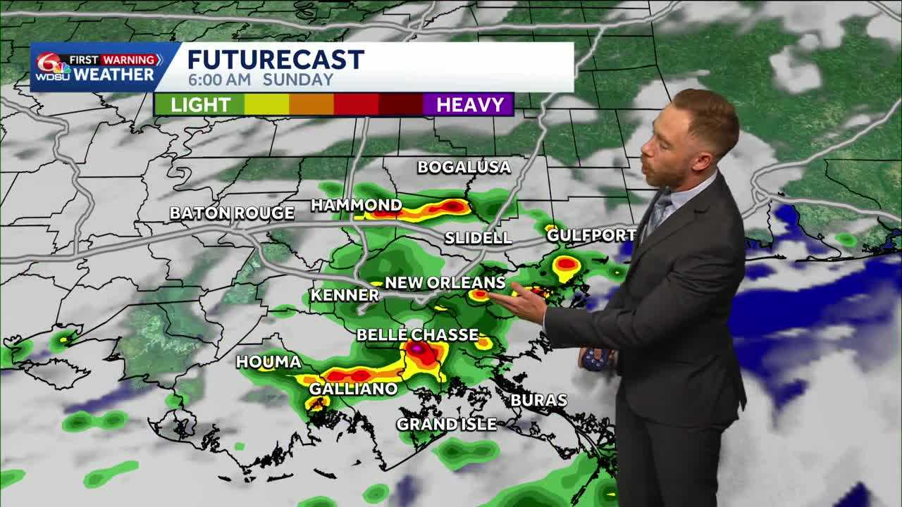
Relief is finally on the horizon. An upper-level area of low pressure centered over the Midwest is pushing a cold front south toward the region.
While this front will not bring a classic blast of crisp autumn air, it will increase our rain chances a bit by early Sunday and help lower our humidity by late Sunday-early Monday.
Highest rain chances early Sunday morning through Sunday mid day. I’ve got rain coverage at 40-50% with the greatest shot at seeing rain on the South Shore.
Rain Expectations and Looking Ahead
When the system moves through, most of southeast Louisiana can expect between a quarter of an inch and a full inch of rainfall, with coastal parishes potentially picking up as much as 1.5 inches in heavier downpours.
Sunday will bring our highest rain coverage of the week. Lower than normal rain chances through early next week with only spotty, mainly coastal storms.
READ MORE:Louisiana’s steamy Saturday forecast ahead of Sunday morning storms possible