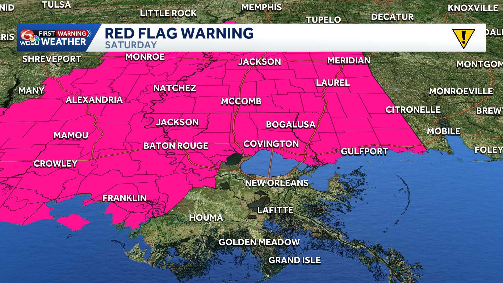
RED FLAG WARNING
The National Weather Service in New Orleans has issued a Red Flag Warning for all of southern Mississippi and parts of southeast Louisiana on Saturday due to critical fire weather conditions.
The warning is in effect from 9 a.m. to 8 p.m. CDT Saturday, replacing the previous Fire Weather Watch.
A cold front moving through the region Saturday will bring very dry air, dropping relative humidity levels into the low-to-mid-30% range. Combined with northerly winds of 10 to 20 mph and gusts up to 30 mph, any fires that develop could spread rapidly.
Areas Affected
Louisiana:
- Ascension (Eastern and Western)
- Assumption
- East Baton Rouge
- East Feliciana
- Iberville
- Livingston (Northern and Southern)
- Pointe Coupee
- St. Helena
- St. James
- St. Tammany (Northern, Southwestern, and Southeast)
- Tangipahoa (Northern, Central, and Lower)
- Washington
- West Baton Rouge
- West Feliciana
Mississippi:
- Amite
- Hancock
- Harrison
- Jackson
- Pearl River
- Pike
- Walthall
- Wilkinson
Safety Recommendations
A Red Flag Warning indicates that critical fire weather conditions are occurring or imminent. The combination of gusty winds, low humidity, warm temperatures, and dry vegetation creates an environment for extreme fire behavior.
Weather officials advise the public to adhere to the following safety measures:
- Avoid outdoor burning: Refrain from burning yard debris, trash, or brush during the warning period.
- Dispose of smoking materials safely: Ensure cigarettes are fully extinguished in proper receptacles, never tossed outside or from vehicles.
- Prevent sparks: Avoid using lawn mowers or power tools on dry grass during peak heat and wind hours, and ensure trailer safety chains are not dragging on roadways.
- Extinguish campfires: Extinguish all outdoor fires and grills completely by dousing them with water until cold.
Residents are encouraged to monitor local updates from the National Weather Service for changes to the forecast.
WIND ADVISORY
Strong north winds are expected to sweep across portions of southeast Louisiana and southern Mississippi beginning late Friday afternoon, bringing gusts that could down tree limbs and cause minor power outages.
The National Weather Service has issued a wind advisory effective from 4 p.m. Friday through 3 p.m. CDT Saturday. Sustained northerly winds ranging from 15 to 25 mph are anticipated, with localized gusts reaching up to 35 mph.
Strong gusts may blow around unsecured outdoor items, such as patio furniture, garbage cans, and seasonal decorations. Unsecured structures or loose property should be properly anchored before wind speeds increase.
Drivers, particularly those operating high-profile vehicles such as semi-trucks, vans, and SUVs, are advised to exercise extra caution on the roadways. Crosswinds on elevated bridges and open highways could make steering difficult.
The advisory encompasses a broad portion of the region, including the greater Baton Rouge and New Orleans metropolitan areas, the Northshore, and coastal parishes, along with several southern Mississippi counties including Pike, Pearl River, Hancock, Harrison, and Jackson.
Residents are urged to take preventative measures Friday afternoon to secure outdoor property and prepare for potential brief power disruptions into Saturday afternoon.
Key Details at a Glance
| Hazard Type | Wind Advisory |
| Expected Winds | North winds 15 to 25 mph; gusts up to 35 mph |
| Timeframe | 4:00 p.m. Friday – 3:00 p.m. CDT Saturday |
| Primary Risks | Downed tree limbs, localized power outages, driving difficulty |
| Recommended Actions | Secure outdoor items; exercise caution while driving high-profile vehicles |
READ MORE:Impact Day Friday & Saturday: Red Flag Warning & Wind Advisory stretches across Southeast Louisiana