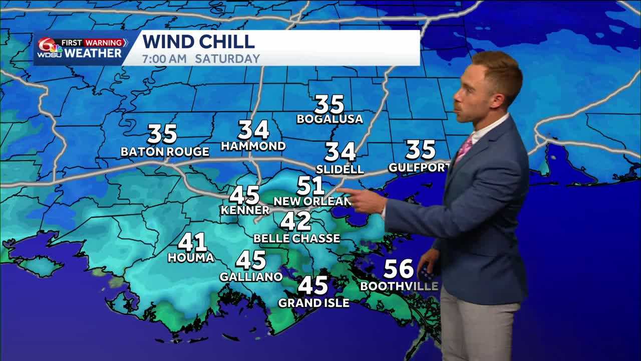
A parade of cold fronts are on the way! The first front will begin bringing cooler air Thursday, followed by a stronger, reinforcing front Friday that will set the stage for a much chillier weekend.
Highs are expected to stay in the 60s Friday through the weekend and into next week. Saturday looks to be the coldest morning, with Northshore wind chills in the mid 30s.
Projected morning lows include:
- Friday: Lower 40s Northshore; lower 50s South Shore
- Saturday: Mid to upper 30s Northshore; upper 40s South Shore
- Sunday: Upper 30s to lower 40s Northshore; lower 50s South Shore
Patchy frost is possible Saturday morning in rural areas north of Lake Pontchartrain, depending in part on how much winds relax. Frost isn’t guaranteed, but gardeners may want to protect tropical plants. Farther north, a first frost or freeze is possible, especially north of the I-20 corridor from Birmingham to Atlanta.
Watching a potential storm system
Conditions will turn breezy Sunday and windy into Monday as a potential storm system approaches. Details are still unclear, but the system could bring higher rain chances to start next week.